Case study · Austin, Texas
CapMetro — the bus stop that says which one it is and what's coming.
Capital Metro is deploying NaviLens on bus shelters and poles across Austin to guide blind and low-vision riders, as part of its Accessible Wayfinding Technology Project.
75+
Bus stops with NaviLens codes
4
Pilot corridors across Austin
42
Languages read aloud
100 ft
Detection distance
The client
Capital Metro (Austin, Texas)
CapMetro is the public transit authority for the Austin metropolitan area: it operates local bus, MetroRapid, MetroExpress, MetroRail and paratransit service across one of the fastest-growing urban regions in the U.S.
Its Accessible Wayfinding Technology Project (AWTP) aims to remove orientation barriers for blind and low-vision riders. To that end, it is piloting two complementary technologies: NaviLens at stops, and Waymap for end-to-end origin-to-destination navigation.
§ The challenge
Make every bus stop identify itself.
- 01
Finding the right stop
For a blind or low-vision rider, reaching the exact stop and confirming it is the right one—not the one across the street—was one of the biggest day-to-day obstacles with CapMetro.
- 02
Knowing which bus is coming and when
Route number, destination and next departure were printed on signage designed for sighted riders. A multilingual, instant digital layer was needed—with no operator-specific app required.
- 03
Piloting with no construction or new infrastructure
As a pilot, the solution had to fit existing shelters and poles—from Lamar to Pleasant Valley—with no power supply, no civil works, and live rider feedback.
§ The solution
One code on every pole. Zero new infrastructure.
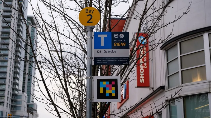
CapMetro adds NaviLens codes to existing poles and shelters at pilot stops. Each code identifies the stop with its Stop ID, the routes serving it, the direction of service and the next departure.
Any rider, using the free NaviLens app, hears the information by voice—in their own language—, along with the distance and direction to the code to approach it safely.
§ Timeline
From a pilot to an accessibility standard.
- 2024
Accessible Wayfinding Technology Project (AWTP)
CapMetro officially launches the AWTP, focused on improving wayfinding for blind and low-vision riders across its bus and light-rail ecosystem in Austin.
- 2024
NaviLens selected
NaviLens is chosen as one of two accessible wayfinding technologies to pilot (alongside Waymap) at representative stops across the system, per the official capmetro.org/plans-development/navilens page.
- 2025
Pilot deployment across 4 corridors
NaviLens codes are installed at shelters and poles along Lamar/Guadalupe, Pleasant Valley, Sunshine/Criss Cole and MetroRapid 801/803 stations — with no civil works.
- Today
Ongoing community feedback
Each code links to a short survey so riders can report their experience, feeding the AWTP service iteration loop.
§ Pilot stops
Lamar, Guadalupe, Pleasant Valley and Sunshine.
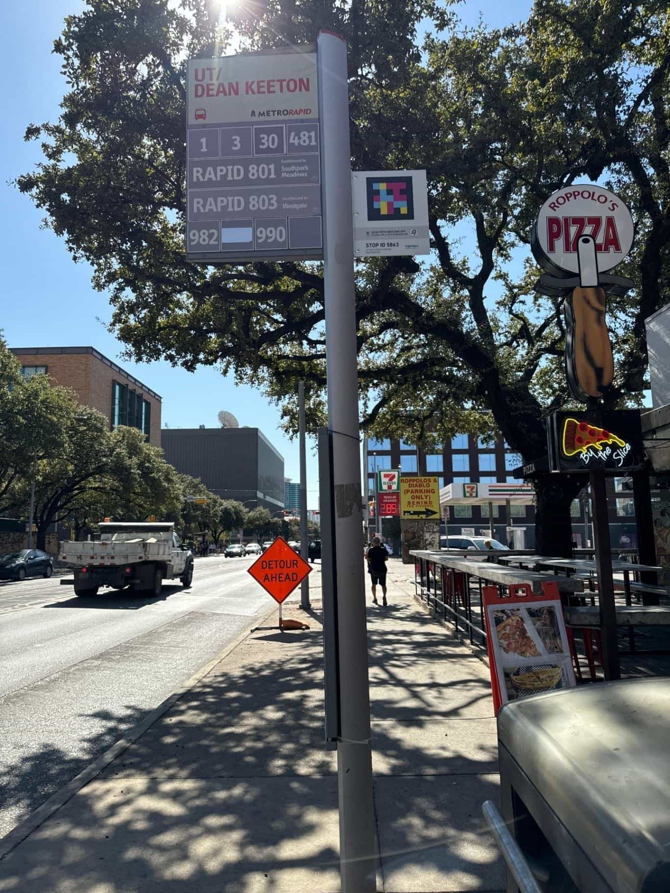
Stop ID 5863
UT / Dean Keeton (Southbound)
MetroRapid 801, 803 and routes 1, 3, 30, 481 across from the University of Texas in Austin.
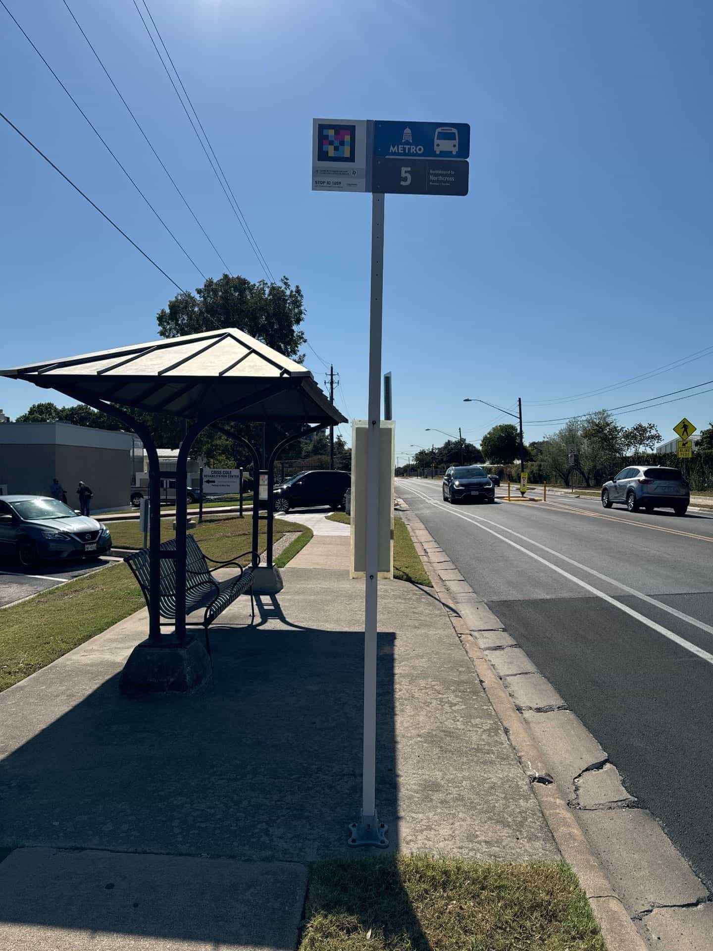
Stop ID 1059
Sunshine / Criss Cole Rehabilitation Center
Route 5 stop next to the Texas rehabilitation center for blind and low-vision individuals.
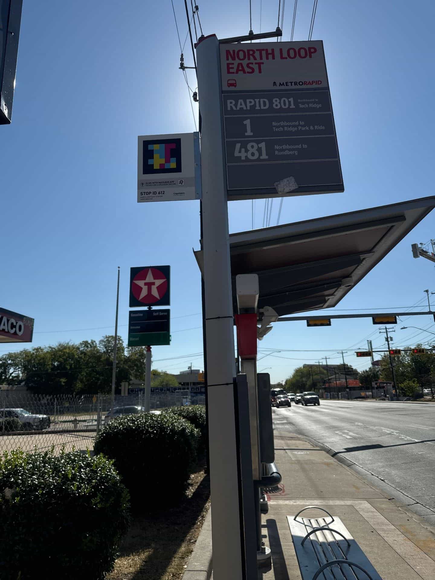
Stop ID 612
North Loop East Station (Northbound)
MetroRapid 801 station and routes 1 and 481 toward Tech Ridge and Rundberg.
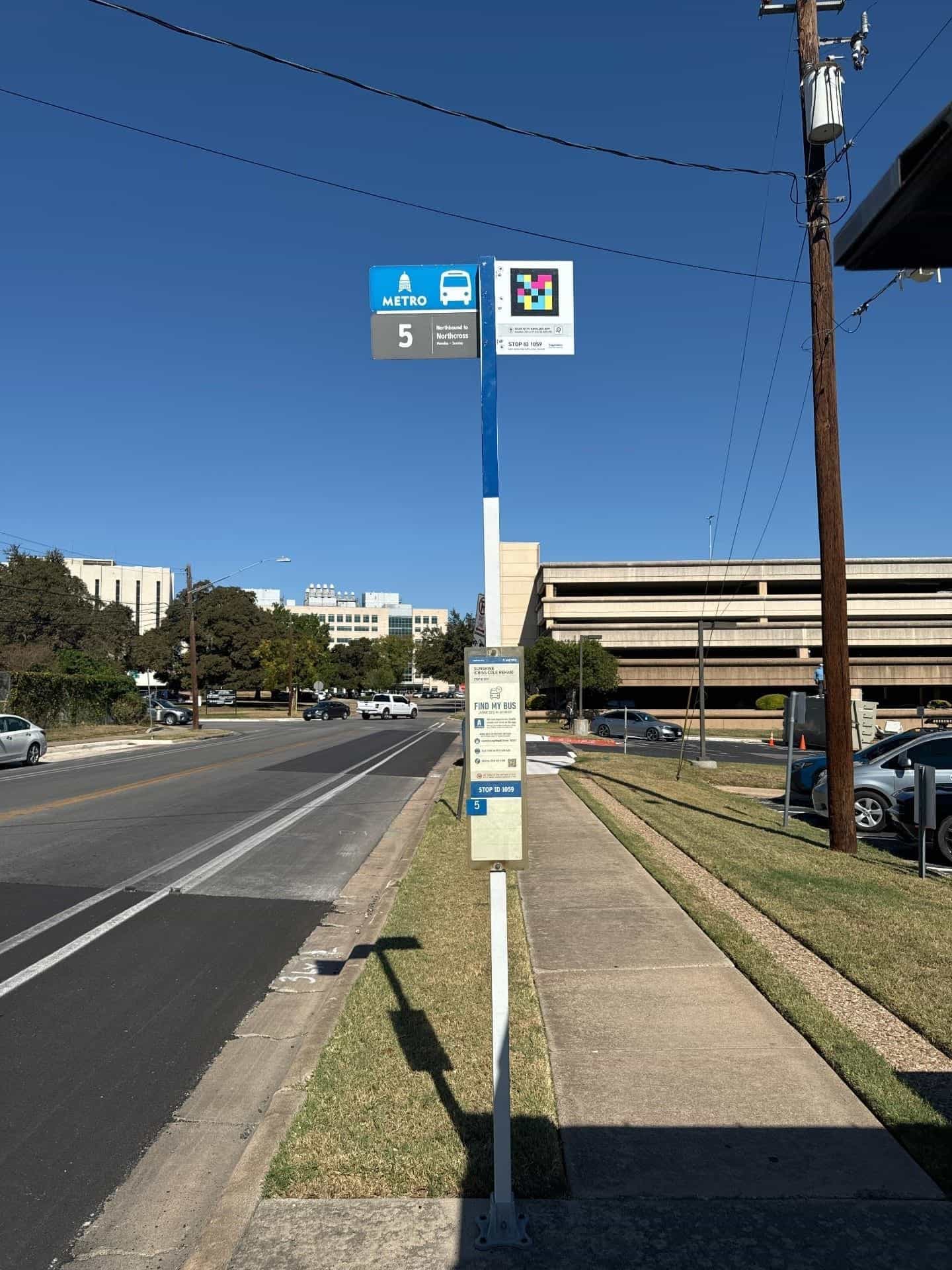
Stop ID 1059
Sunshine Station — Stop 1059
Pole with NaviLens code and a "Find My Bus" panel on the Route 5 corridor toward Northcross.
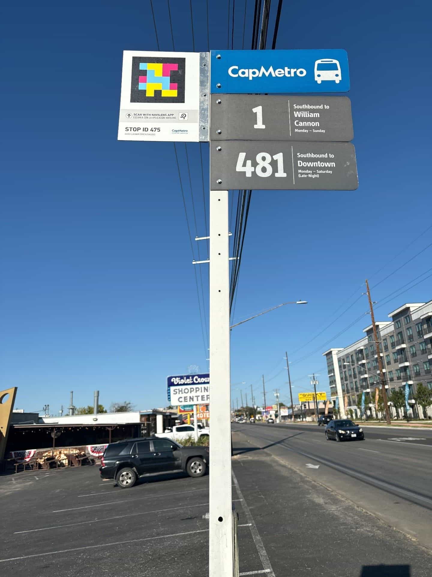
Stop ID 475
6600 Lamar / Brentwood
Lamar corridor: routes 1 and 481 toward William Cannon and Downtown, with the code attached to the stop pole.
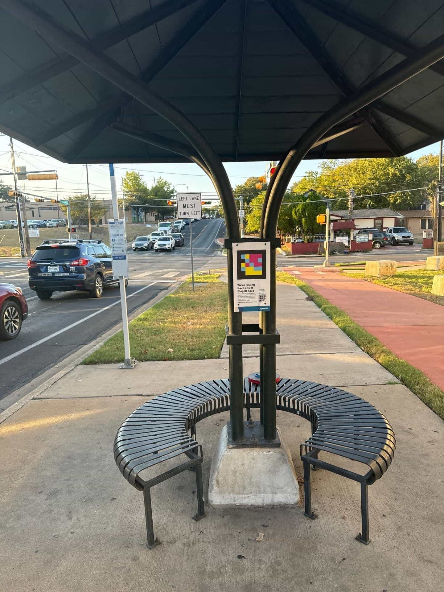
Stop ID 1373
851 Pleasant Valley / Webberville
Shelter with a "We're testing NaviLens at Stop ID 1373" sign on the Pleasant Valley corridor.
§ What they said
What CapMetro says on its blog.
“Navigating access to public transit can be difficult for those with disabilities, specifically individuals who are blind or have low vision. We believe using public transit should be safe and easy for everyone. That is why CapMetro is piloting two user-friendly apps, NaviLens and Waymap, which are designed to assist blind and low-vision customers when using our services.”
“We're now focused on taking accessibility technology even further, so that we can make it easier for everyone to use public transportation by reducing reliance on physical maps or assistance from others. The introduction of NaviLens and Waymap will help empower our customers when navigating between bus stops and stations independently with greater confidence and ease.”
§ Results
A bus network anyone can use.
Stop ID
Stop ID, route, direction and next departure read aloud
0 works
Stuck to existing shelters and poles, no new infrastructure
Local + Rapid
Covers local routes, MetroRapid 801/803 and MetroRail stations
"We want anyone—sighted or not—to be able to reach their stop, know which bus is coming and board with confidence. NaviLens helps the stop itself tell that story."
§ And your network?
Your next station can also speak.
Tell us about your network, your pain points and the KPIs you want to move. We’ll show you how NaviLens would fit—with comparable cases.