Case study · Metro Transit · St. Louis, Missouri
Downtown St. Louis learns to be read out loud.
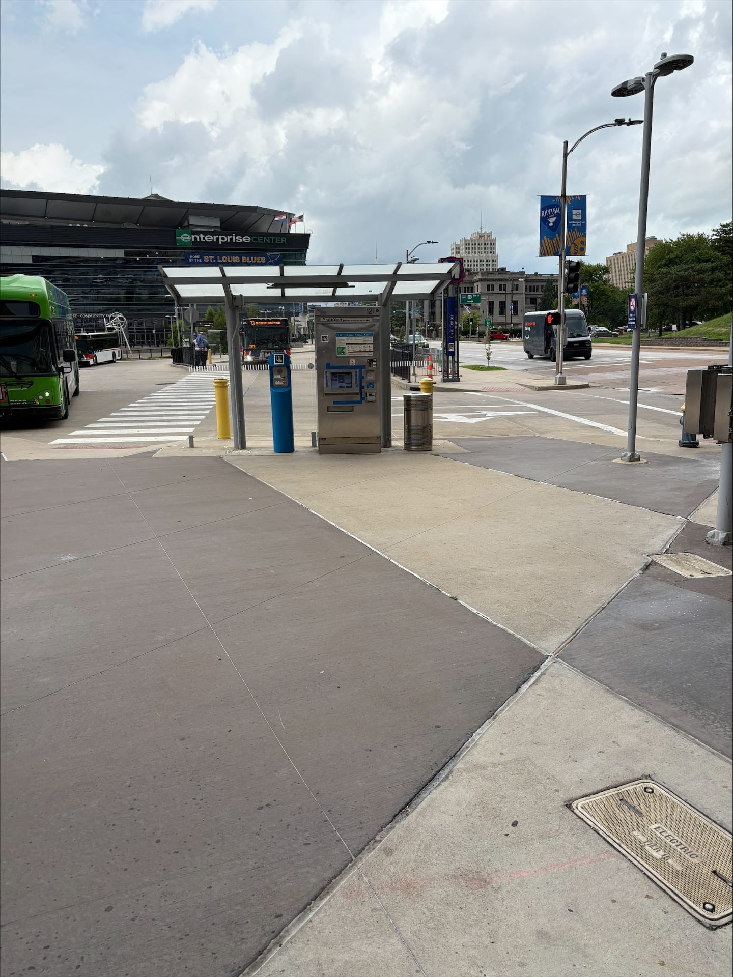
In July 2025, Metro Transit launched a NaviLens pilot at the Civic Center Transit Center — next to the Enterprise Center, home of the St. Louis Blues — and at 24 stops of the #10 Gravois-Lindell MetroBus route. The codes now live on the ticket vending machines, the "Bus Info" shelter signs and the MetroLink platforms.
Civic Center
St. Louis Transit Center (401 S. 14th St., 63103) and MetroLink line
16 bays
Bus shelters fitted with NaviLens codes on every "Bus Info" sign
#10 Gravois-Lindell
24 stops on MetroBus route #10 also fitted with NaviLens codes
Open House
July 17, 2025 — Metro, GoodMaps and NaviLens test the system with the public
The client
Metro Transit · Bi-State Development St. Louis · Missouri · USA
Metro Transit is the agency that operates MetroLink (light rail), MetroBus and Metro Call-A-Ride across the St. Louis metropolitan area (Missouri and Illinois), under Bi-State Development. The Civic Center Transit Center — at 401 S. 14th Street, next to the Enterprise Center — is one of downtown's largest interchanges, where MetroLink and dozens of bus routes converge.
In 2025 Metro launched an Accessible Wayfinding Apps Pilot Program aimed at people with low vision or blindness, people with cognitive disabilities, non-native English speakers and new transit riders. The agency partnered with NaviLens and GoodMaps and opened the trial to the public with an Open House on July 17, 2025, collecting feedback through October 31.
§ The solution
A "Bus Info" code on every shelter, a voice from 100 feet away.
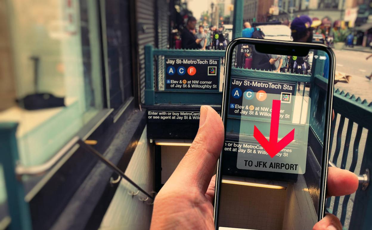
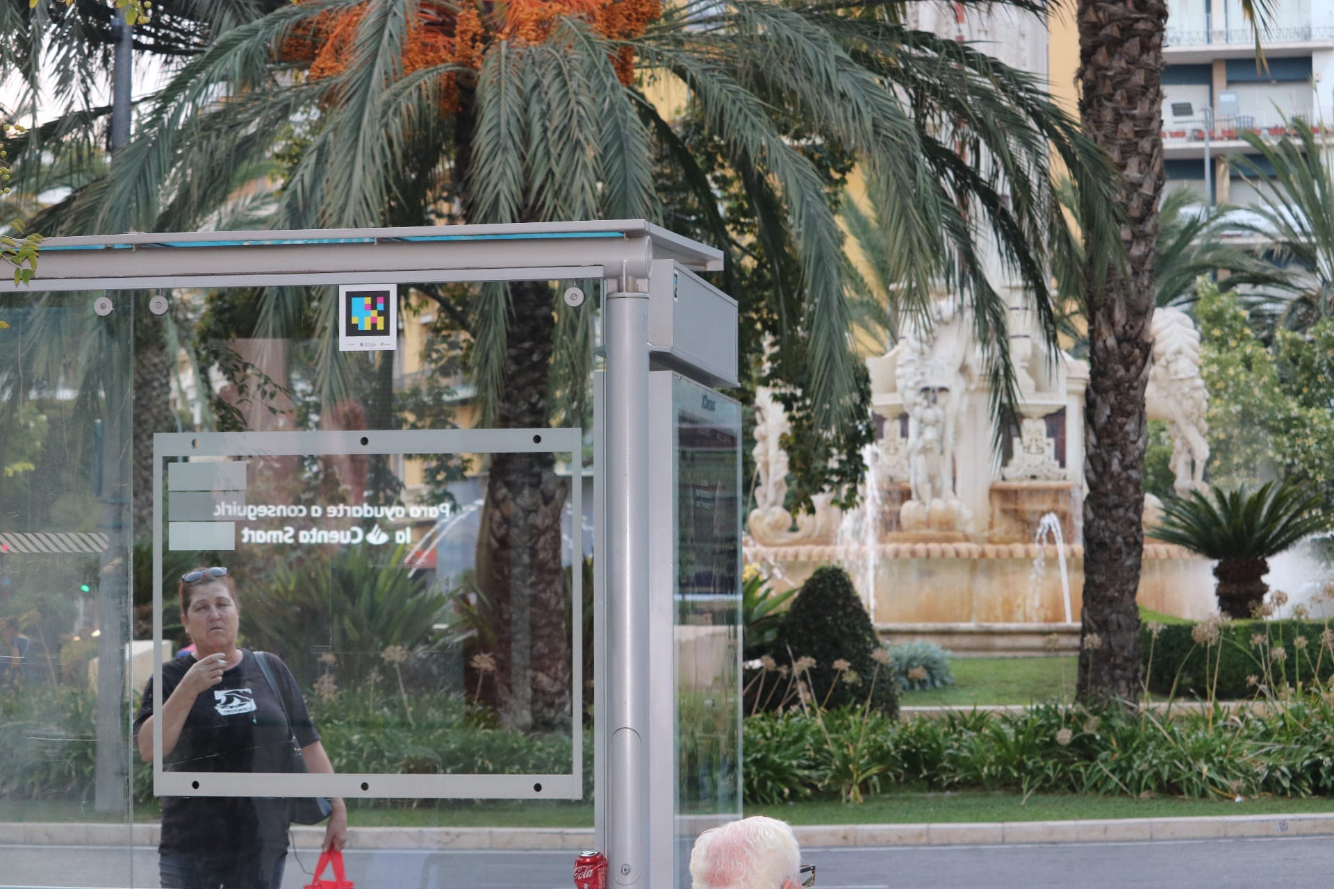
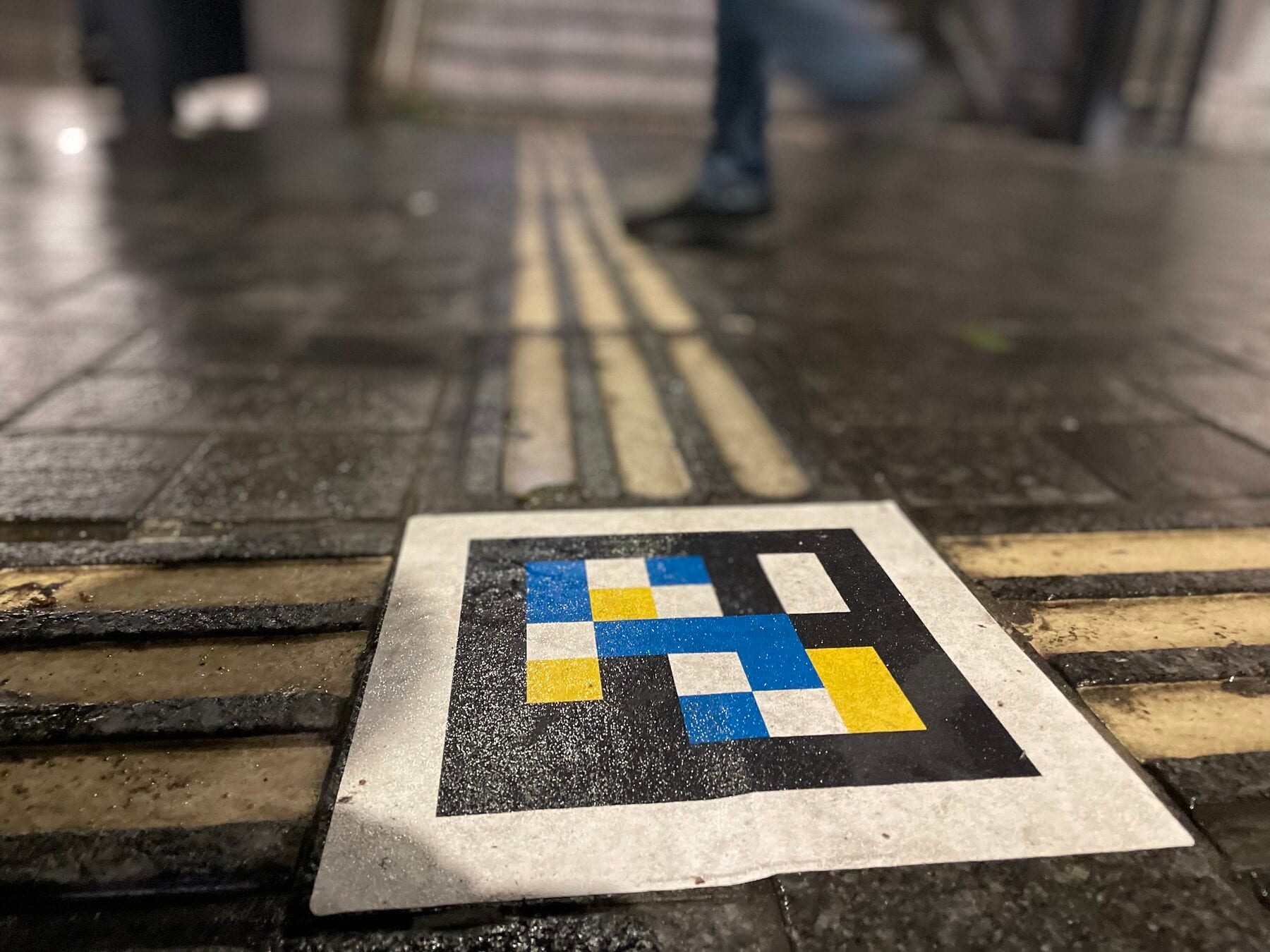
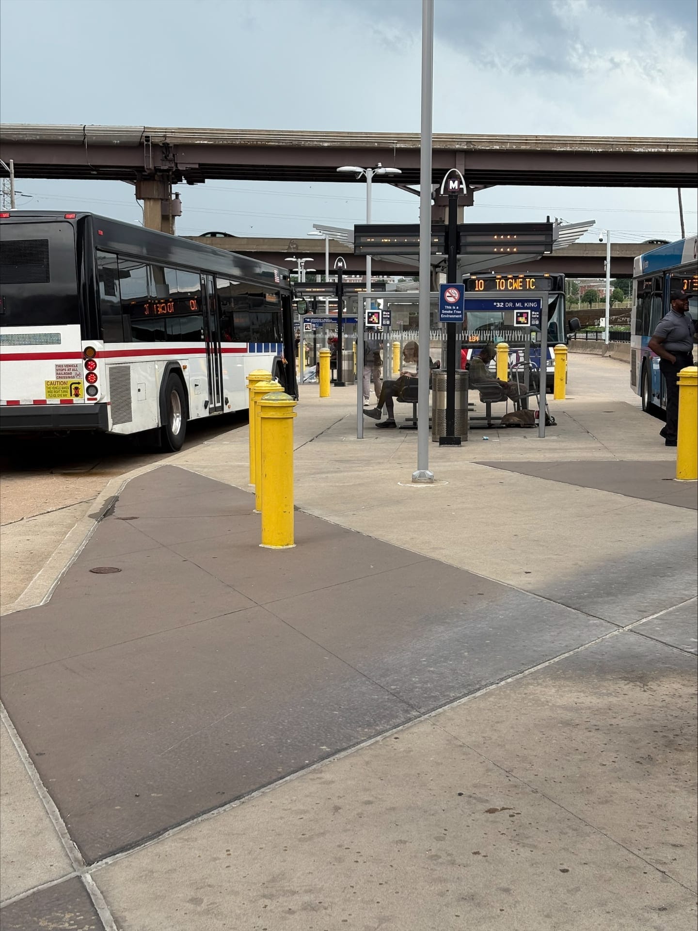
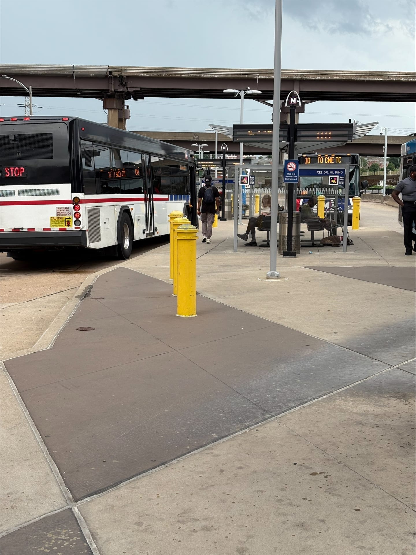
Every shelter at the Civic Center Transit Center carries a blue "Bus Info" sign with a NaviLens code printed next to the traditional signage. The app detects the code from 100 feet (≈30 m) away, in any lighting condition and at a 160° angle, and delivers the stop ID, route, direction, next arrival and exactly how many steps the rider is from the shelter.
The ticket vending machines (TVMs) and the "Welcome" signs also carry codes: a blind rider doesn't need to have visited the station before in order to locate the TVM, buy a ticket and orient themselves toward the right bay. The system runs alongside the GoodMaps indoor navigation pilot and is evaluated through public feedback.
§ Visitor journey
From the TVM to the platform, without asking anyone.
Arrival · Enterprise Center
"Welcome" with a NaviLens code
The first code at the interchange sits under the TVM canopy, next to the blue welcome sign. A blind person arriving from the street scans it from several meters away and the app confirms that they are at the entrance of the Civic Center Transit Center.
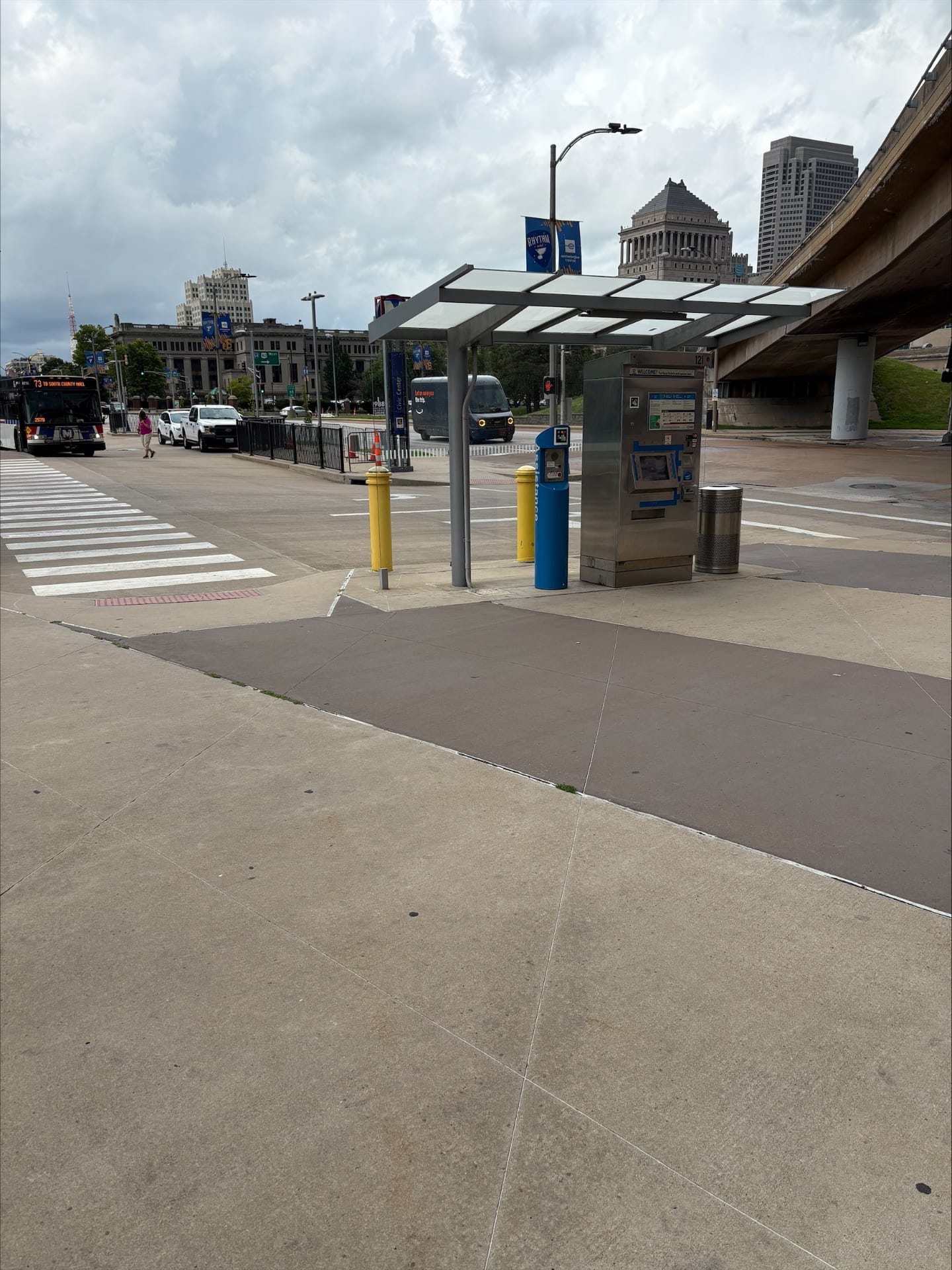
TVM · Ticket purchase
Machine with a code and assistance post
The code on the machine identifies the TVM and describes aloud the steps to buy a ticket. The blue "Assistance" post remains as a human safety net, but it is no longer the only option for a low-vision rider.
Bus Bay · Shelter
"Bus Info" — #10 to CWE TC, #32 Dr. ML King
At each of the 16 bays, the "Bus Info" sign carries its own code. The user points the phone and the app tells them which bay they are in, which routes serve it, how long until the next bus and how to orient themselves toward the vehicle's door.
Transit flow · Backpack and bus
Codes embedded in the normal journey
The codes are integrated into the natural flow of the station, not in a segregated area: any rider — with or without a visual disability — walks past them when moving between bays. Inclusion without stigma.
MetroLink · Connection
Platform, walkway and bays in a single read
The codes cover the MetroLink platform, the track crossing, the customer service area, the restrooms and the validators: the official pilot page lists 16 bays + platform + ticketing + security check as points covered by the system.
Route #10 Gravois-Lindell · 24 stops
From the interchange to the street
The pilot extends to the stops along MetroBus route #10 Gravois-Lindell (12 stops northbound and 12 southbound, between Gravois @ Chippewa and Forest Park @ Euclid), with real-time bus information and points of interest along the way.
Metro Transit is collecting public feedback through October 31, 2025 via dedicated NaviLens and GoodMaps surveys, alongside its Travel Training program. The pilot is part of a broader accessibility update described by Citizens For Modern Transit.
§ What they said
“Metro Transit will host an open house at the Civic Center Transit Center in downtown St. Louis on Thursday, July 17, to allow transit customers and the public to test new accessibility technology from GoodMaps and NaviLens. NaviLens code signs will be installed at the Civic Center Transit Center and along some stops of the #10 Gravois-Lindell MetroBus route for customers to test starting on July 17.”
“NaviLens is a smartphone application that detects colorful codes using a smartphone camera from up to 100 feet away. The codes provide information such as the bus stop ID, route, direction, real time transit information, location of the bus shelter, and even announce how far away from the stop/shelter the user is and provide direction signals they need to move closer.”
“Metro Transit recently provided an update on the status of multiple accessibility-related projects currently underway, including the wayfinding pilot at the Civic Center Transit Center with GoodMaps and NaviLens designed for customers with low vision or blindness, cognitive disabilities, non-English speakers and new transit users.”
§ And your network?
Your next station can also speak.
Tell us about your network, your pain points and the KPIs you want to move. We’ll show you how NaviLens would fit —with comparable cases.