Étude de cas · Miami · Floride · États-Unis
Government Center parle : Miami-Dade DTPW pilote NaviLens dans son hub multimodal.
Le Miami-Dade Department of Transportation and Public Works (DTPW) lance le premier outil de navigation accessible dans une station de transport du comté : une preuve de concept avec NaviLens à Government Center Station, hub multimodal où convergent Metrorail, Metromover, Metrobus, les bus Broward Transit et la passerelle vers MiamiCentral. Codes à fort contraste sur la signalétique existante, lecture vocale à +30 m, sans viser, en 42 langues.
1re du comté
Première station Miami-Dade avec navigation accessible par la voix
Metrorail · Metromover · Metrobus
Hub multimodal connecté à MiamiCentral (Brightline · Tri-Rail)
42 langues
Lecture vocale à plus de 30 m, sans viser
Sans travaux
Collé sur la signalétique existante, sans modification architecturale
L’opérateur
Miami-Dade DTPW · Department of Transportation and Public Works
Le Department of Transportation and Public Works (DTPW) exploite le réseau de transport de Miami-Dade County — Metrorail (40 km de métro aérien, 23 stations), le Metromover gratuit du centre-ville, Metrobus et STS paratransit — au service d’un comté de plus de 2,7 millions d’habitants et de millions de visiteurs par an.
Government Center Station est le cœur intermodal du centre-ville de Miami : nœud de correspondance entre Metrorail et Metromover, terminus Metrobus et Broward County Transit, et connecté par passerelle piétonne au-dessus de la NW 3rd Street à MiamiCentral — la gare Brightline et Tri-Rail. Chaque jour, travailleurs du quartier gouvernemental, touristes et résidents combinent deux ou trois modes dans un même trajet.
En 2025, le DTPW — piloté par le bureau de Jarice Rodriguez — choisit Government Center pour lancer une preuve de concept avec NaviLens : le premier outil de navigation accessible déployé dans une station du comté. L’objectif : comprendre sur le terrain comment les personnes aveugles, malvoyantes, avec handicap cognitif ou ne parlant pas anglais s’orientent entre Metrorail, Metromover et les boucles Omni et Brickell — et valider le modèle avant de l’étendre au réseau.
§ Comment ça a été déployé
Wayfinding vocal dans un hub multimodal.
- 01
Codes sur la signalétique existante
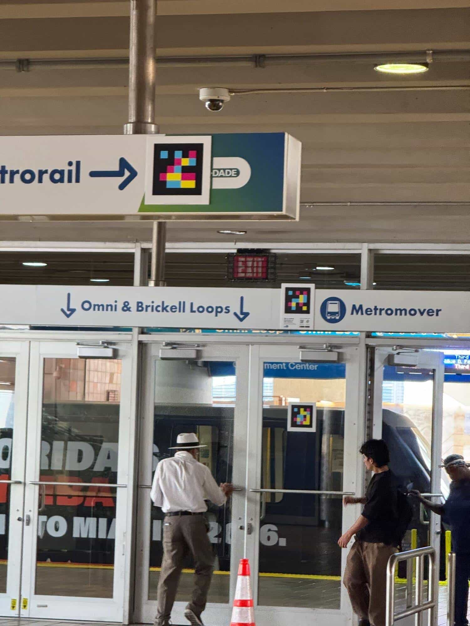
Les codes NaviLens s’intègrent aux panneaux suspendus « Metrorail → », sur les portes vers les boucles Omni & Brickell du Metromover et près du pictogramme du train — sans remplacer la signalétique visuelle de Miami-Dade Transit et sans travaux structurels dans la station.
- 02
Points critiques identifiés
Au-delà du wayfinding entre modes, chaque code est programmé avec les informations du point : quais Metrorail, accès au Metromover et à ses boucles, connexions Metrobus et passerelle vers MiamiCentral, plus services client et plaques commémoratives comme celle du « 2017 New Metrorail Fleet ».
- 03
Preuve de concept mesurable
Le pilote est conçu comme proof-of-concept : affiches « We’re testing NaviLens on this Station » avec QR de téléchargement des apps NaviLens et NaviLens GO, recueil de retours de personnes aveugles et malvoyantes, et benchmark international avec LA Metro Union Station, MTA New York ou TfL Londres pour déployer ensuite le standard sur l’ensemble du Metrorail.
§ Galerie de Government Center
Le hub du centre-ville, désormais audible.
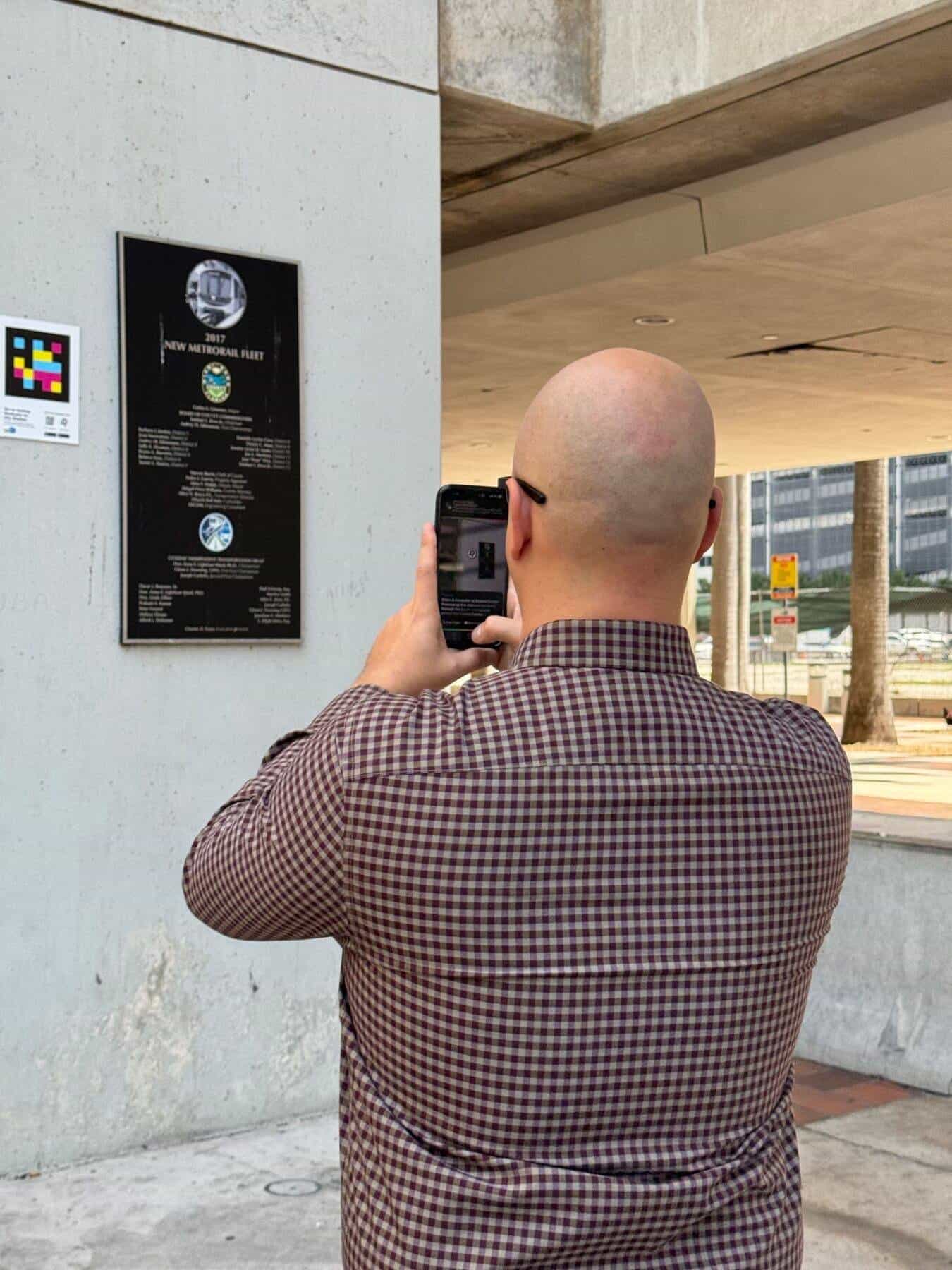
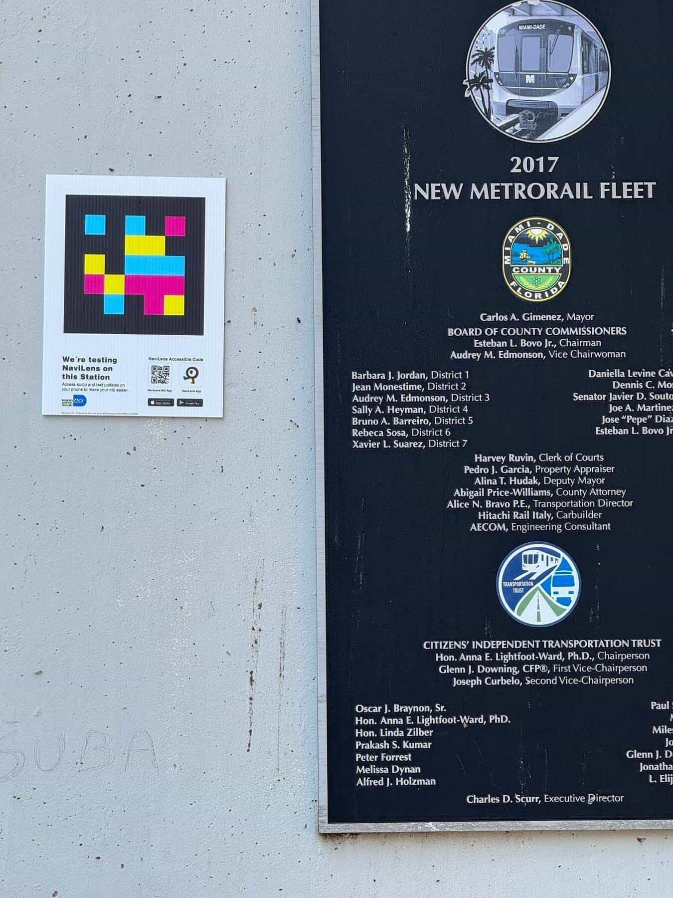
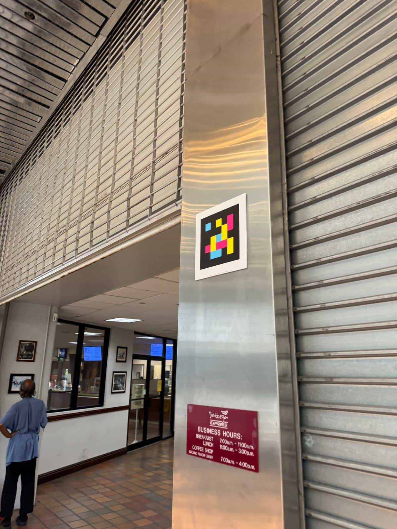
§ § NaviLens à Miami · vidéo
Government Center, en mouvement.
Visite réelle du hub multimodal montrant comment les codes NaviLens — à l’entrée du Metrorail, sur les colonnes et les plaques commémoratives — se lisent à distance sans viser. Le même réseau de codes fonctionne sur téléphone ou lunettes intelligentes, pour les personnes aveugles ou malvoyantes, les voyageurs internationaux et quiconque a besoin d’orientation instantanée.
Station Government Center · Miami-Dade DTPW
§ Pourquoi c’est important
Accessibilité multimodale pour le centre-ville de Miami.
Premier déploiement
C’est le premier outil de navigation accessible que le DTPW de Miami-Dade déploie dans une station de transport du comté. Un précédent réplicable pour les 23 stations de Metrorail et les arrêts du Metromover.
Vraiment multimodal
Government Center concentre Metrorail, Metromover (boucles Omni et Brickell), Metrobus, Broward Transit et la passerelle vers MiamiCentral. NaviLens coud ces modes par la voix, en temps réel, sans que le voyageur doive décoder deux systèmes de signalétique parallèles.
42 langues pour Miami
Dans une ville bilingue anglais / espagnol avec un flux constant de touristes latino-américains, brésiliens, européens et caribéens, lire chaque panneau dans la langue du téléphone du voyageur n’est pas un bonus — c’est ce qui distingue un système accessible d’un système qui se contente de respecter la norme.
«Multiple Lenses» · téléphone + Meta
Le pilote s’appuie sur plusieurs « lentilles » d’accès : les apps NaviLens et NaviLens GO sur le smartphone du voyageur et l’intégration aux lunettes intelligentes Meta pour scan mains libres. Un même réseau de codes sert les personnes aveugles, malvoyantes, avec handicap cognitif et les visiteurs — sans les enfermer dans un appareil unique.
§ Et votre réseau ?
Votre prochaine gare peut aussi parler.
Parlez-nous de votre réseau, de vos points critiques et des indicateurs clés que vous souhaitez améliorer. Nous vous montrons comment NaviLens s’intégrerait, à partir de cas comparables.