Case study · SMRT Buses · Woodlands · Singapore
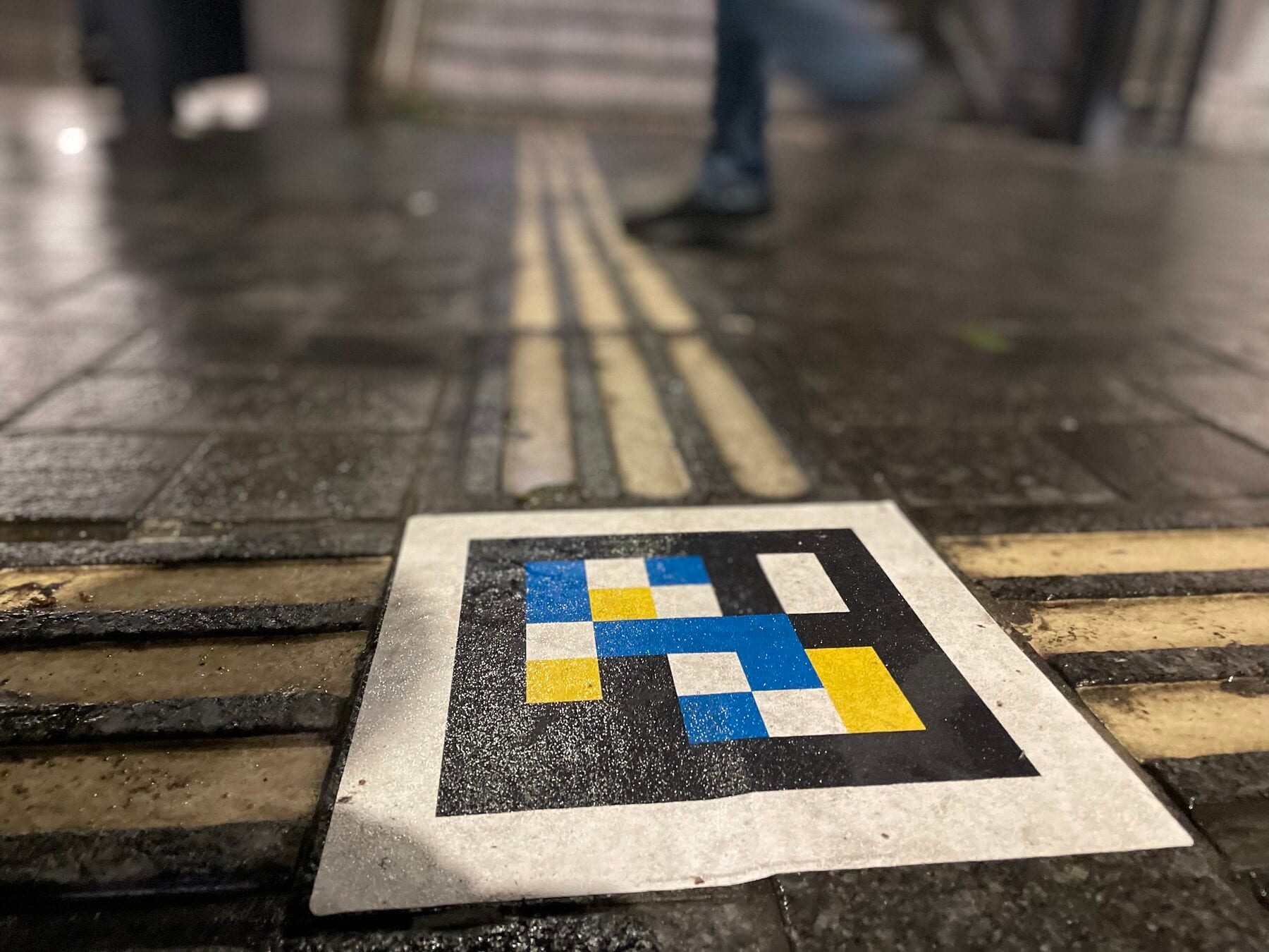
Asia's first interchange with NaviLens on the tactile paving.
On 31 May 2022, SMRT Buses switched NaviLens on at the Woodlands Integrated Transport Hub and became the first public transport operator in Asia to do so. The ddtag codes are printed directly on the tactile paving tiles: the blind traveller follows the guide line with their cane and the phone announces, up to 30 m away, which bus bay or destination lies ahead.

31 May 2022
Official launch of NaviLens at Woodlands ITH — Asia's first hub with NaviLens
Up to 30 m
Distance at which the phone detects the ddtags embedded in the tactile paving
15 destinations
Dynamic information read aloud from a single code at an intersection
NaviLens + GO
Accessible app (2022) plus AR layer for every traveller (Aug 2023)
The client
SMRT Buses · Singapore · Woodlands ITH
The Woodlands Integrated Transport Hub connects SMRT's bus interchange with the MRT North-South Line (NSL) and the upcoming Thomson-East Coast Line, next to Causeway Point and the new Woodlands Square: one of the busiest transport nodes in northern Singapore, the gateway to Malaysia.
In May 2022, SMRT chose Woodlands as the pilot hub to switch on NaviLens before extending it to Bukit Panjang and Choa Chu Kang. Media coverage — The Straits Times, 联合早报, Mediacorp Channel 8 — turned it into the reference case the Ministry of Transport cited in Parliament as an example of public-transport inclusion.
§ The solution
One code per crossing, 15 destinations in a single voice.
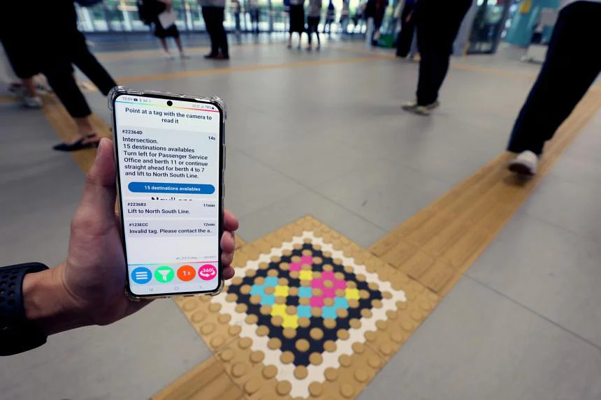
SMRT embedded the ddtag codes directly into the tactile paving tiles. At every intersection, a single code returns a dynamic menu: “Intersection. 15 destinations available” — the app reads options such as “Turn left for Passenger Service Office and berth 11” or “continue straight ahead for berth 4 to 7 and lift to North South Line”.
The blind traveller follows the guide line with the cane, scans the code at the crossing and picks by voice which direction to take. The North-South Line, bus bays 4 to 11, the accessible toilets and the passenger service office are all a single scan away.
§ Journey
From the accessible entrance to the NSL platform, with no need to ask.
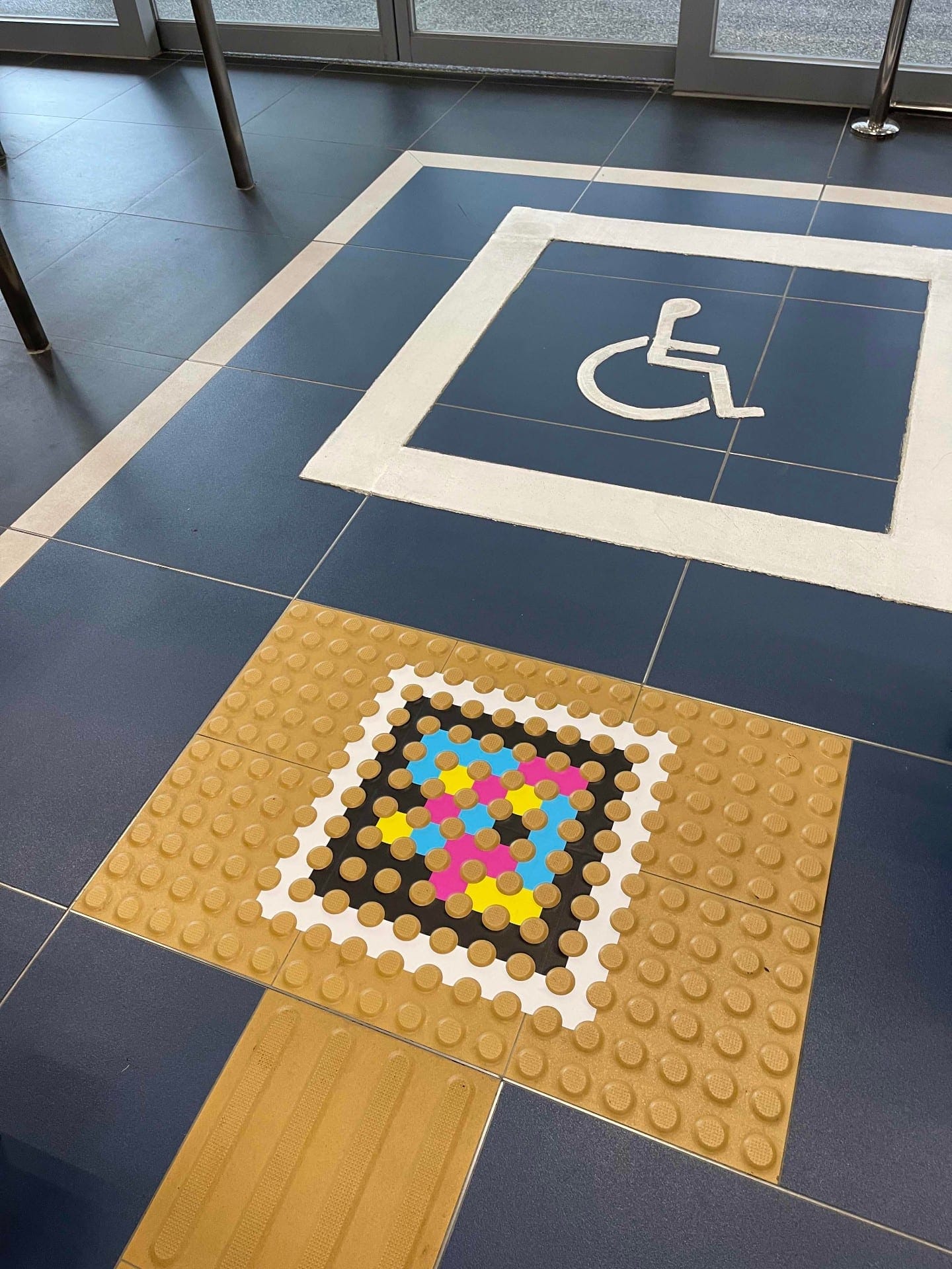
Accessible entrance · Floor
The code next to the wheelchair pictogram
At the entrance reserved for people with reduced mobility, the code is set into the tactile tile, right below the wheelchair pictogram. Any blind person arriving up the ramp scans it and knows they are entering through the accessible entrance.
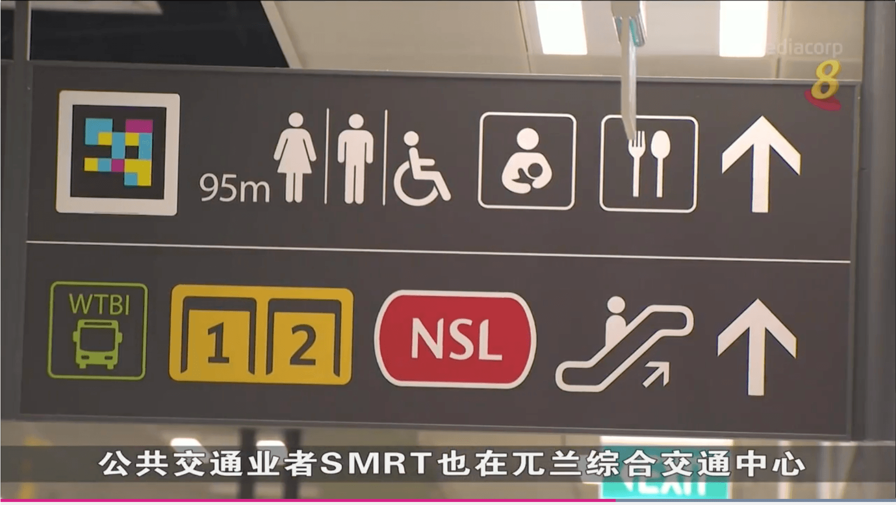
Concourse · Woodlands Square
Codes on the hanging signs
The wayfinding signs in the concourse include a NaviLens icon next to the arrows. The traveller points the phone at the ceiling and the app reads which bay each route serves, without having to decipher the visible panel.
Wayfinding sign · Detail
“95 m → toilets · NSL · bays 1-2”
The code is built into the sign's own typography: same visual hierarchy as the accessible-toilet pictograms and the NSL line. What the sign says by sight, NaviLens says out loud to those who cannot read it.
Tactile grid · Overview
“Follow the line, scan the crossing”
The yellow guide lines draw a grid with a NaviLens code at every crossing. The blind traveller does not need to memorise the hub map: each intersection identifies itself on the phone and offers the routes available from that exact point.
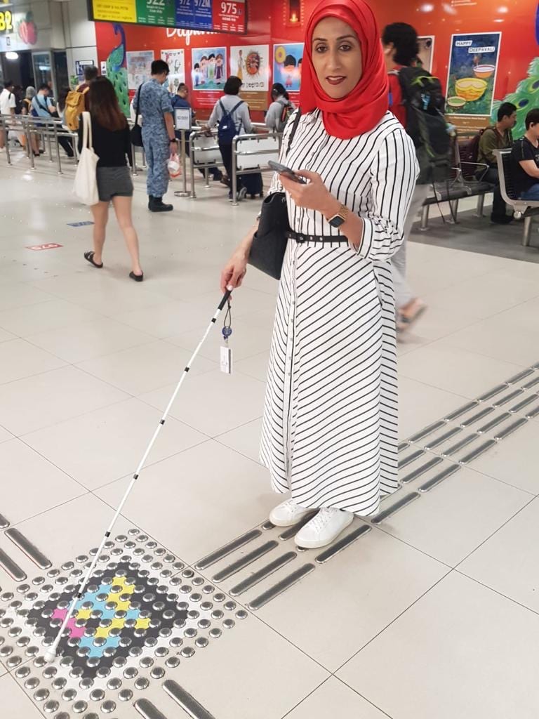
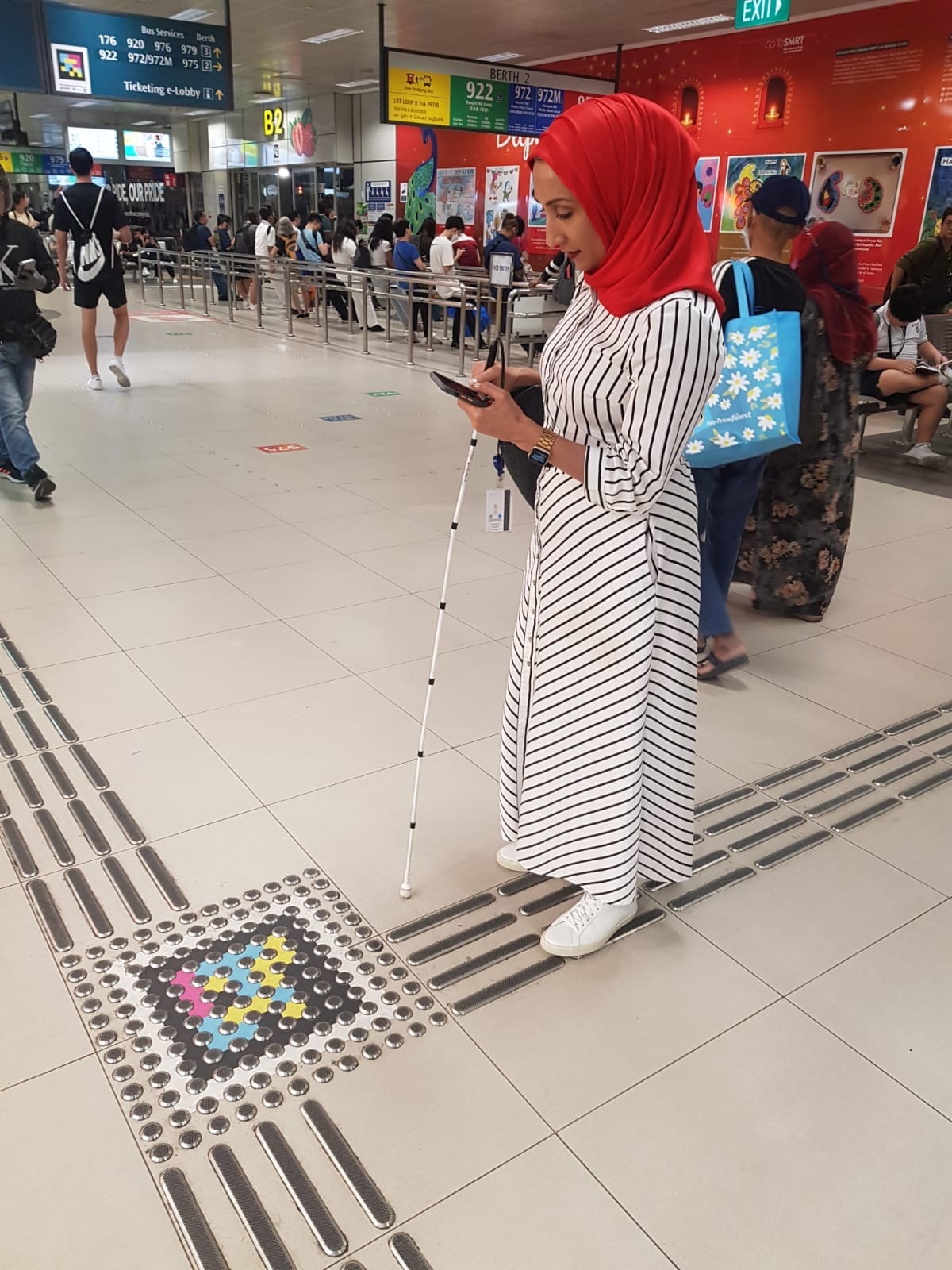
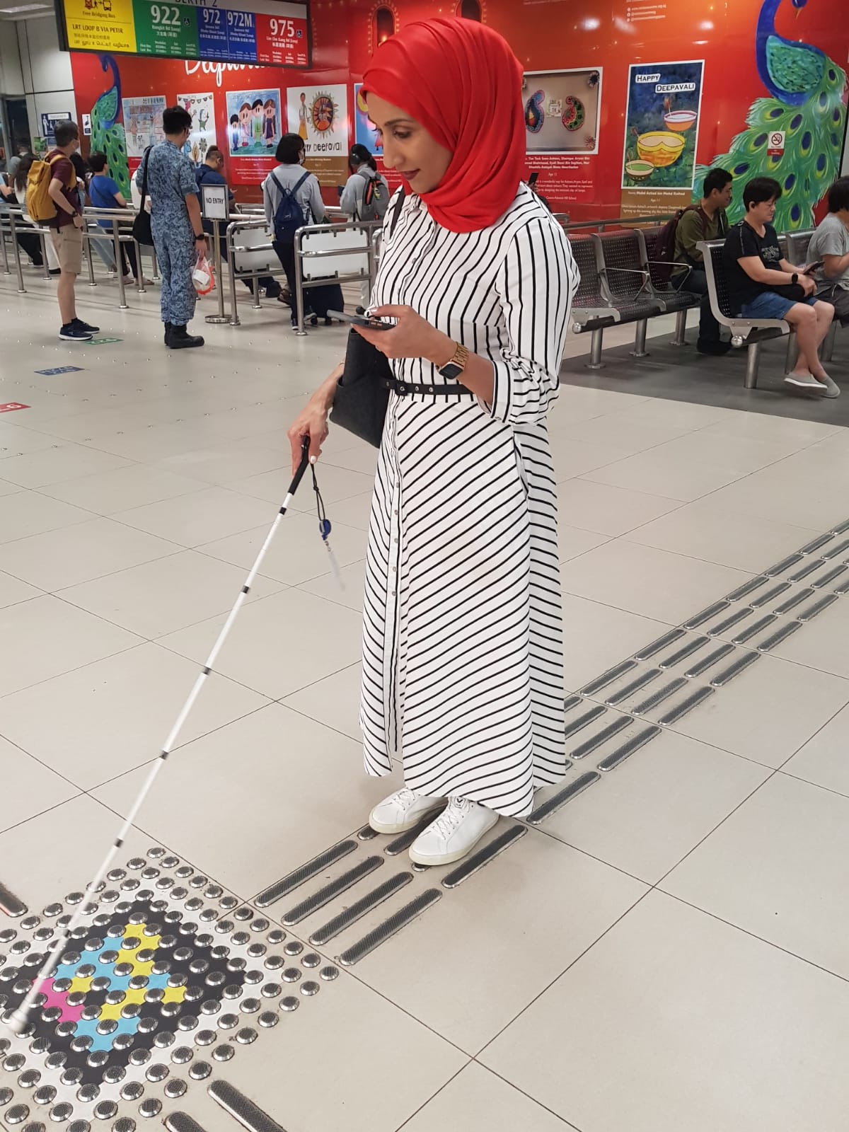
User with cane · Detection
The cane finds the crossing, the phone reads the code
The white cane detects the texture change of the guide line; at that very point, the phone is already reading the NaviLens code. The two systems — tactile and digital — were designed to meet on the same square metre.
Bay 2 · Services 920 / 922 / 972 / 975
“Berth 2 → 922 Bangkit Rd · 975 Lim Chu Kang”
At the bay itself, the code identifies the berth and the app reads which services use it. On her phone, the user knows whether she is standing in front of the 922 to Bangkit Road or the 975 to Lim Chu Kang before boarding the bus.
Living hub · Deepavali festival
The hub works in any scenario
The codes keep working under the Deepavali themed decoration, with military personnel and residents walking around. Accessibility does not stop when the hub puts on a festive look: the system keeps reading, intact, the crossing and the bay.
After the success of Woodlands, SMRT extended the system to Bukit Panjang and to Choa Chu Kang, and in August 2023 it added NaviLens GO — an augmented-reality layer for every traveller — on top of the same ddtags already installed.
§ What they said
“An app that helps visually impaired people navigate Woodlands Integrated Transport Hub independently was rolled out on Tuesday (May 31). The NaviLens app directs commuters by detecting marker tags embedded in the tactile paving at the interchange.”
“SMRT Buses has launched the full implementation of NaviLens at Woodlands Integrated Transport Hub — a first-in-Asia mobile application for the visually impaired to navigate bus interchanges with greater confidence and independence.”
“兀兰综合交通中心 为视障者提供语音导航 — 视障者如今只要手握智能手机,就能通过语音导航在兀兰综合交通中心独立通行,找到想乘搭的巴士。镜头朝向前方,应用就会自动扫描多达12米远的彩色 ddtag 标识。”
“LTA and the public transport operators are continually exploring ways to enhance the travel experience for commuters with disabilities. SMRT Buses' deployment of NaviLens at its bus interchanges is one such initiative, allowing visually impaired commuters to scan ddtags from a distance and receive audio information on their phones.”
§ And your network?
Your next station can also speak.
Tell us about your network, your pain points and the KPIs you want to move. We’ll show you how NaviLens would fit —with comparable cases.