§ Case study · MTA NYC Transit
One wayfinding layer for all of NYCT: subway, bus and the sidewalk.
Under the New York City Transit umbrella, NaviLens stitches the whole journey together: station entry, platform column, train exterior and interior, and bus stop pole — the same code, the same voice, in 42 languages.
NYC Transit
Subway + Bus + street access under a single umbrella: NYCT
50+
Subway stations with NaviLens across Manhattan and the Bronx
Bx12 · M23 · M66
SBS and local routes with codes on shelters, poles and buses
$2M
US DOT SMART Grant to expand NaviLens across NYCT
The client
MTA · New York City Transit (NYCT)
New York City Transit is the Metropolitan Transportation Authority arm that runs the New York subway (over 470 stations, 24/7 service) and the MTA Bus network across Manhattan, the Bronx, Brooklyn, Queens and Staten Island — the largest urban public transport system in North America.
NYCT chose NaviLens as a shared accessibility layer: the same colored-square code works at the station entry, on the platform column, on the train's outer skin, inside the R211 car and on the JCDecaux bus stop pole on the corner. The rollout is funded by the US DOT SMART Grant and by New York State allocations.
§ Three legs of the journey
Street, platform and train stitched by a single code.
- 01
From the street to the turnstile
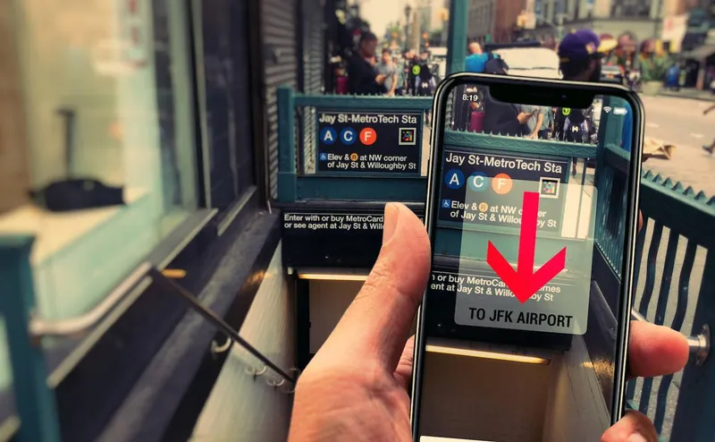
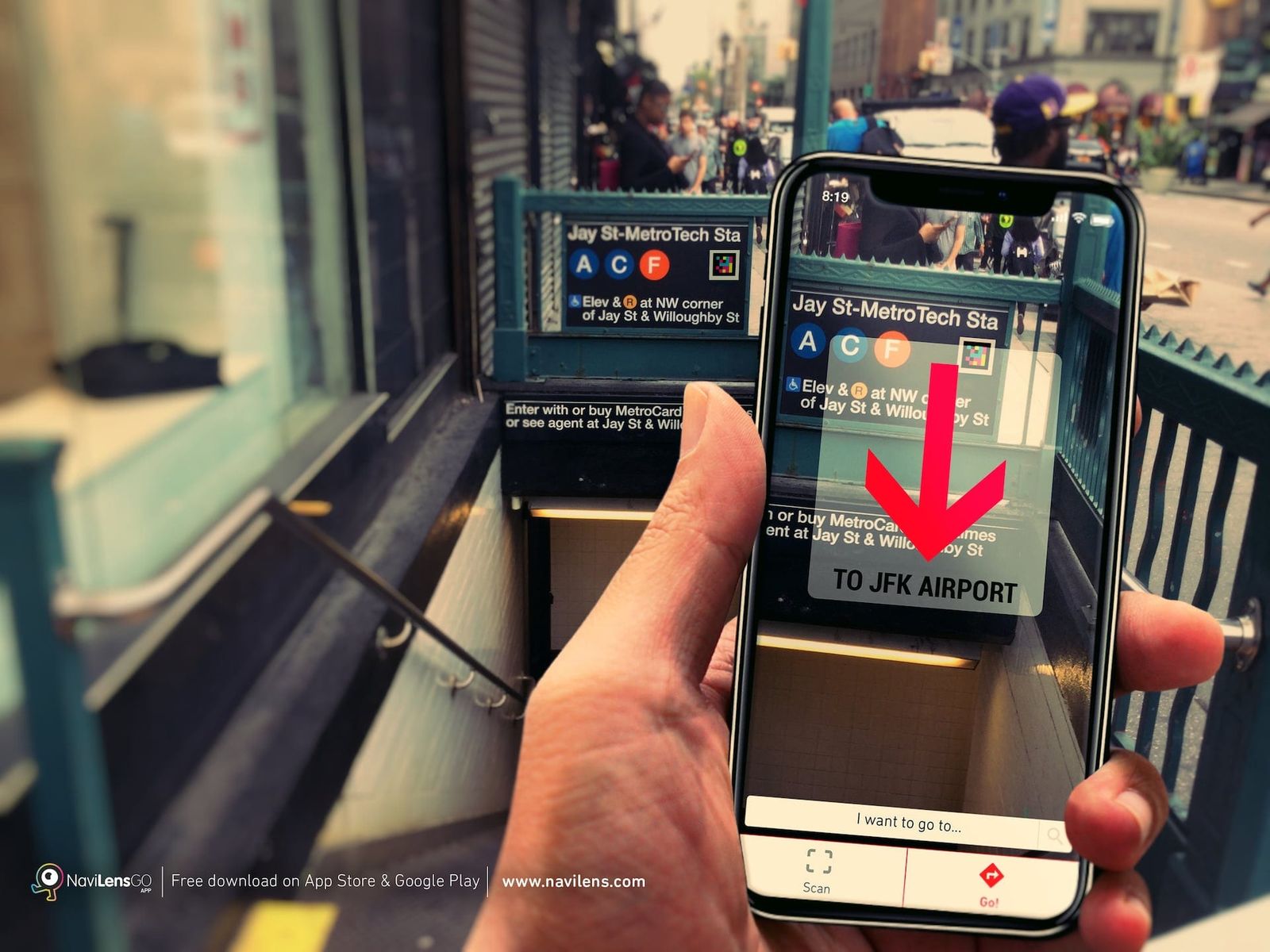
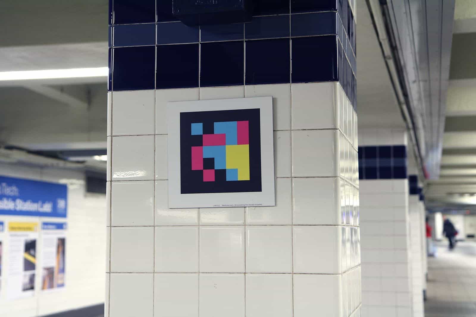
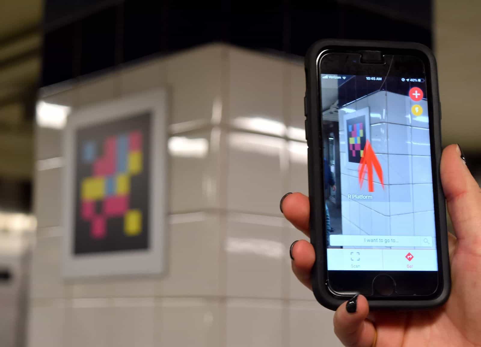
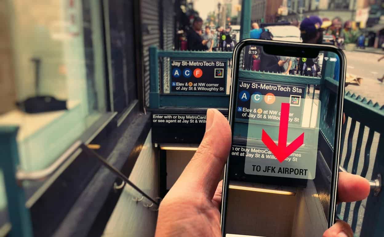
The code appears at the station entrance: an “Entry · 4 5 Uptown & The Bronx” sign with the NaviLens square next to the text. The app announces the lines, the direction and how to enter — before going down the stairs.
- 02
From the platform to the car
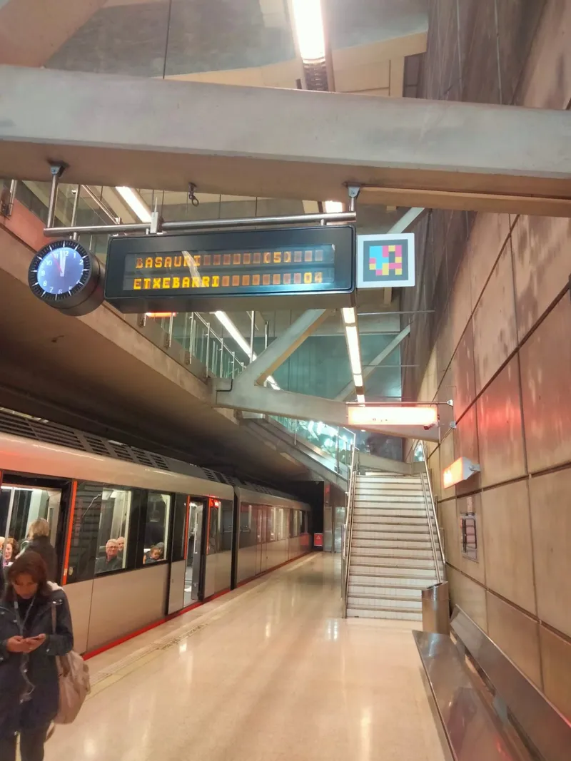
Codes on platform columns, on the train exterior and inside the car, next to the “Priority Seating” sign. Riders never lose the thread: station, line, direction and service info in their language.
- 03
At the curb, by the stop
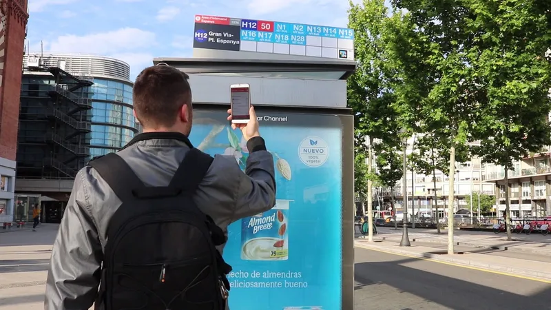
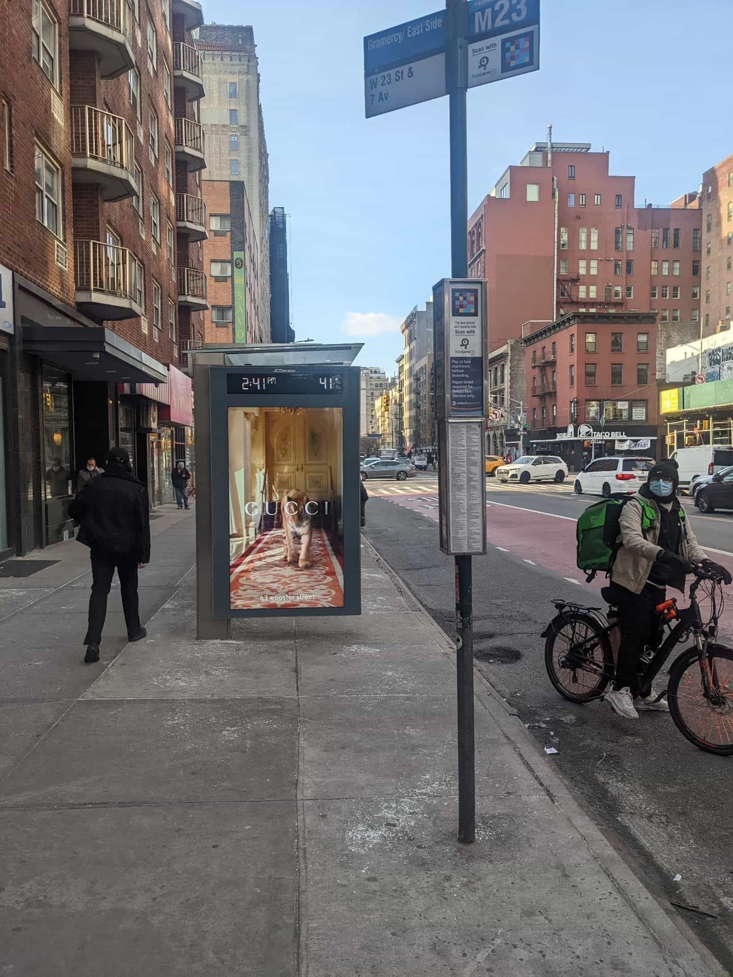
Bus stop poles (M23 Gramercy/East Side, M66, Bx12-SBS…) with a “Scan with NaviLens GO” panel stuck to the sign: arrival times and service info read aloud, without opening another app.
§ NYCT bus stops
The same code on the stop pole.
On Manhattan and Bronx stops (M23-SBS, M66, Bx12-SBS…) NYCT places a “Scan with NaviLens GO” panel right on the pole, next to the sign. The app detects the code from several yards away and speaks the route, the direction and when the next bus is coming — no need to open another app or read tiny schedules on the side.
Same visual language as the subway: colored squares framed in white, same audio flow, same way to ask for directions.
§ The subway, live
From the Accessible Station Lab to the app in your hand.
§ NYCT timeline
From the Brooklyn lab to systemwide rollout.
- 2019-2020
Accessible Station Lab · Jay St-MetroTech
MTA, Transit Innovation Partnership and Transit Tech Lab pick Jay Street-MetroTech as an accessibility lab: NaviLens lands on columns, stairs, elevators and platform edges.
- Jul 2023
Disability Pride Month — NYCT announcement
MTA announces the NaviLens expansion beyond Jay Street, with coverage in Manhattan and Bronx stations and pilots at bus stops in Senate District 47 (funded by Senator Brad Hoylman-Sigal).
- Dec 2023
Year-end review · “Significant progress”
The official “MTA Makes Significant Progress in Expanding Accessibility in 2023” release lists NaviLens among the key 2024 projects, alongside elevators, ramps and braille.
- 2024
US DOT SMART Grant · $2M
NYCT receives the $2M US DOT SMART Grant to bring NaviLens to the six 6-line stations and trains, and to Bx12-SBS, M23-SBS and M66 stops and buses.
- 2024-2025
Full system: subway + bus + R211
Official yellow sign inside the new R211 cars, codes on JCDecaux Manhattan bus stop poles, and a living mta.info/NaviLens page with a feedback survey (updated Sep 2025).
§ What they said
What NYCT and the New York press said.
“NaviLens is rolling out at all 6 subway stations, on all 6 line subway cars, and on all Bx12-SBS bus stops and buses, with M23-SBS and M66 bus stops and buses to follow.”
“It speaks to the customer — low vision and blind customers who are using the code to help get wayfinding navigation, both on the sidewalks to find the bus stop or an entrance to the subway and throughout the subway system.”
“The MTA living lab tests more than a dozen features such as wayfinding apps, braille, tactile maps and floor treatments to improve accessibility across the subway system.”
§ Results
A single accessibility layer for all of NYC Transit.
Subway + Bus
A single voice wayfinding layer for subway and bus under NYCT
Audio + AR
NaviLens (blind / low vision) and NaviLens GO (everyone else), with AR arrows
42 languages
Information read in the user's phone language, with no setup
§ And your network?
Your next station can also speak.
Tell us about your network, your pain points and the KPIs you want to move. We’ll show you how NaviLens would fit—with comparable cases.